• Skip to main content
  • Skip to primary sidebar
  • Skip to footer

LIRPC

  • About
    • Resources
      • Reports
      • News
        • In the News
        • Calendar of Events
      • Meetings
      • Key Links
      • Suffolk County Economic Development Corporation
    • Mission
    • Chairman’s Letter
    • Who We Are
    • Projects of Regional Significance
    • Connect
  • Our Work
    • Economic Development
    • Energy
    • Environment
    • Equity
    • Housing
    • Taxation
    • Transportation
    • Long Island 2035
  • LINAP
    • Background & Scope
    • Initiatives
      • Long Island Water Quality Challenge (LIWQC)
      • Nitrogen Smart Communities
      • Hempstead Bay Water Quality Monitoring Program
      • Sustainable Landscaping Resource Hub
      • Fertilizer Management
      • Nutrient Bioextraction Initiative
      • Reduce Nitrogen Pledge
      • Subwatersheds Wastewater Plans
      • Suffolk County Wastewater Management District Feasibility Study
      • Water Reuse
    • Partners & Initiatives
    • LINAP Newsletters
  • Nitrogen Smart Communities
  • LI Garden Rewards Program
  • Economic Flood Risk Study
You are here: Home / In the News / Study Identifies Long Island Waterfront Development Opportunities 

Study Identifies Long Island Waterfront Development Opportunities 

The Long Island Regional Planning Council has released a comprehensive study of waterfront zoning and land use in Nassau and Suffolk counties.

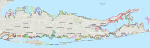
Commissioned by LIRPC and conducted by LiRO GIS, the study creates a database of nearly 100,000 waterfront business properties spanning both counties, two cities, 13 towns and 64 villages, according to a council statement.

The interactive database can be used by planners, governments and economists, and help identify coastal economic development, current uses and future opportunities in six core sectors, including aquaculture and fishing; marine construction; marine transportation; offshore wind development; marine research; and recreation and tourism.

The study also identifies damaged properties that were acquired after Hurricane Sandy, since surge and sea-level rise are concerns and remain critical factors in zoning, planning and economic development.

Long Island’s 79 local jurisdictions each have distinct zoning categories, classifications and definitions, resulting in nearly 600 zoning designations, according to LIRPC Chairman John Cameron.

“The Council felt there was a need for a centralized and consistent database of what the current waterfront uses are and identify where the greatest blue economy development opportunities may lie ahead,” Cameron said in the statement. “We live on an island and are highly dependent upon our waters, not only for beauty and recreation but economically.”

The waterfront database can be accessed on the council’s website at lirpc.org. 

David Winzelberg/July 10, 2023


Filed Under: In the News

Primary Sidebar

Footer

Contact

516-571-7613
516-571-7614

1864 Muttontown Road
Syosset, NY 11791
[email protected]

STAY INFORMED

Enter your email address to receive email updates from the LIRPC:

Connect

Facebook Twitter LinkedIn

Copyright © 2025 Long Island Regional Planning Council